Mapped the Fluid Border Between El Paso and Ciudad Juarez
- Label
- Mapped the Fluid Border Between El Paso and Ciudad Juarez
- Principal Link
- nicoleantebi.com
- Description
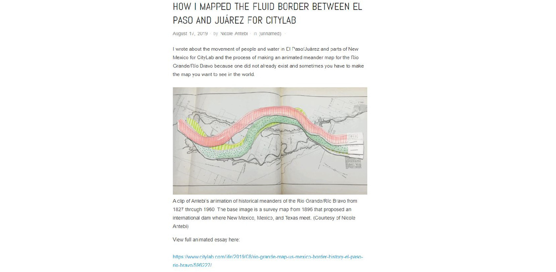
- The animation shows the historical movements of the Rio Grande / Rio Bravo from 1827 to 1960. The image is based on an 1896 topographic map that proposed an international dam where New Mexico, Mexico and Texas are located. Animation is a record not only of historical changes, but also an image of the river's real life. It is the history of the agency of the river and the changing place of the world. Like the motionless lines of a traditional map, the border prints an idea of how the river should move towards the landscape.
- Creators
- Nicole Antebi
- Contact Information
- nicole.antebi@gmail.com
- twitter.com
- Status
- active