Delimitations: A Survey of the 1821 United States-Mexico Border
- Label
- Delimitations: A Survey of the 1821 United States-Mexico Border
- Principal Link
- delimitationsblog.tumblr.com
- Additional Link
- www.mcasd.org
- Description
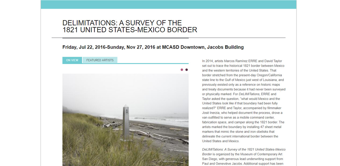
- Delimitations is the first attempt to draw the border between Mexico and the United States from 1821 to 1847. It is a collective and nomadic artistic-community work carried out by Marco Ramirez, Erre, Richard Taylor, and Jose Inerzia. Although the blog that initially introduced the process is temporarily disabled, the coordinates in GPS can be viewed through a KMZ file (Google Earth).
- Creators
- Marcos Ramirez ERRE & David Taylor
- Status
- active